New Yorkers there will be a surface trough approaching today after this trough passes, high pressure briefly visits the region tonight before sliding offshore Sunday. Bundle Up because there will be mainly dry and very cold conditions expected through tonight. Highs today are expected to range from the upper 20s to mid 30s, about 10-15 degrees below normal. There could be an isolated snow shower or snow flurries today into early this evening. The colder than normal temperatures continue tonight into Sunday with a chance of snow developing Sunday afternoon with the approach of a warm front. The warm front slowly moves across Sunday night, with a resulting transition of snow to a wintry mix across the interior and plain rain along the coast. The wintry mix lingers across the interior for early Monday with plain rain elsewhere. Eventually just plain rain encompasses the region later on Monday. The rain tapers off after a cold frontal passage Monday evening. Are you Winter Prepared Today! Be Weather Resilient!
The Three Day Forecast Calls For:
Today
Partly sunny, with a high near 34. Wind chill values between 25 and 30. West wind around 13 mph.
Tonight
Partly cloudy, with a low around 26. Wind chill values between 20 and 25. Northwest wind 7 to 15 mph.
Sunday
A 40 percent chance of snow after noon. Mostly cloudy, with a high near 36. Wind chill values between 20 and 30. Northwest wind around 7 mph becoming southwest in the afternoon.
Sunday Night
Snow before 1am, then rain. Temperature falling to near 33 by 9pm, then rising to around 38 during the remainder of the night. South wind around 6 mph, with gusts as high as 20 mph. Chance of precipitation is 90%. New snow accumulation of less than one inch possible.
Monday
Rain, mainly before 3pm. High near 46. Southwest wind 7 to 10 mph, with gusts as high as 23 mph. Chance of precipitation is 90%. New precipitation amounts between a quarter and half of an inch possible.
Monday Night
Partly cloudy, with a low around 34.
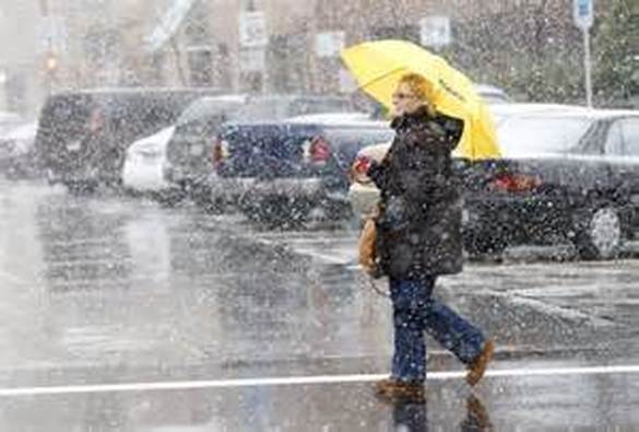
Make Sure You Have Your Winter Boots!
The Three Day Forecast Calls For:
Today
Partly sunny, with a high near 34. Wind chill values between 25 and 30. West wind around 13 mph.
Tonight
Partly cloudy, with a low around 26. Wind chill values between 20 and 25. Northwest wind 7 to 15 mph.
Sunday
A 40 percent chance of snow after noon. Mostly cloudy, with a high near 36. Wind chill values between 20 and 30. Northwest wind around 7 mph becoming southwest in the afternoon.
Sunday Night
Snow before 1am, then rain. Temperature falling to near 33 by 9pm, then rising to around 38 during the remainder of the night. South wind around 6 mph, with gusts as high as 20 mph. Chance of precipitation is 90%. New snow accumulation of less than one inch possible.
Monday
Rain, mainly before 3pm. High near 46. Southwest wind 7 to 10 mph, with gusts as high as 23 mph. Chance of precipitation is 90%. New precipitation amounts between a quarter and half of an inch possible.
Monday Night
Partly cloudy, with a low around 34.
Make Sure You Have Your Winter Boots!
 RSS Feed
